
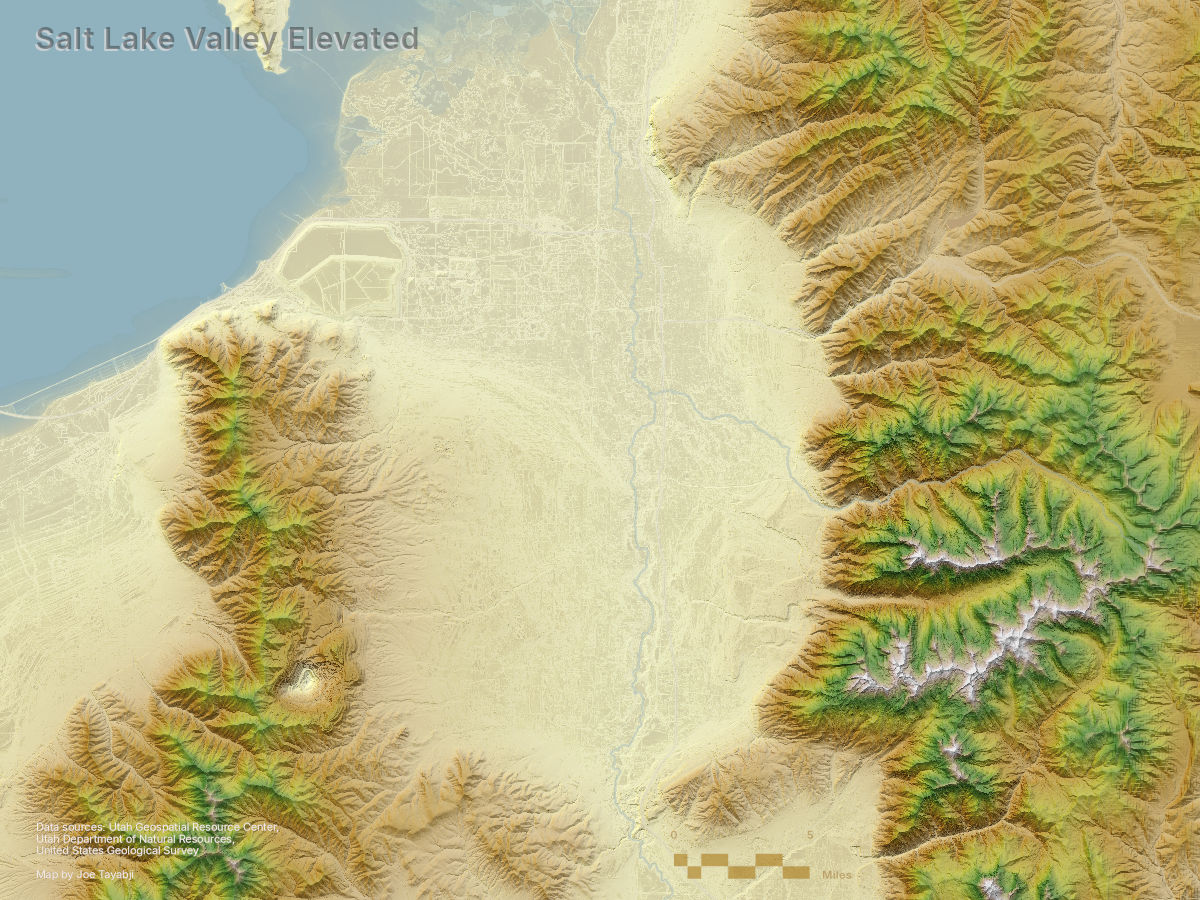
Salt Lake Valley Elevated
Using Elevation for Urban and Natural Terrain
I am a GIS professional with experience in both ESRI and open-source solutions, web mapping, SQL, Python, and R.
My interests include interactive data visualization, GIS automation, outdoor recreation, emergency management, and city planning.
In the spring of 2025 I received my Master of Science in GIS from the University of Utah.
In my free time I can be found in the desert or the mountains on a bike, or at a local venue seeing live music.
jtayabji@gmail.com
Please reach out if you would like to connect or discuss any of my work.
Using Elevation for Urban and Natural Terrain
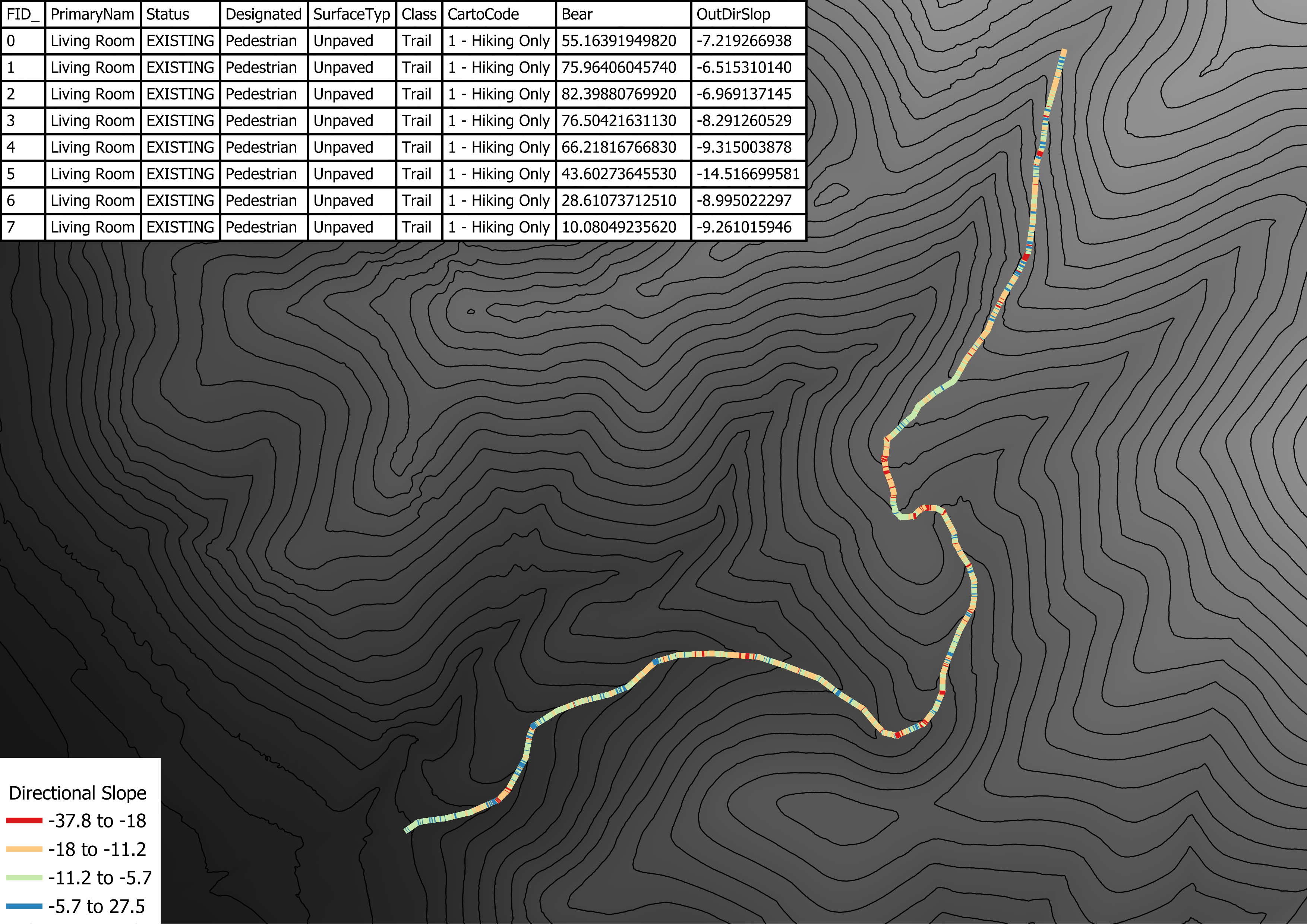
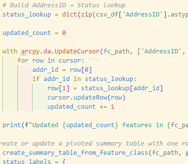
GEOG 6180: Geoprocessing with Python
GEOG 6180: Geoprocessing with Python
GEOG 5170: Geospatial Field Methods
GEOG 6161: Capstone in GIS

GEOG 6160: Spatial Modeling and Geocomputation

GEOG 6000: Advanced Geographical Data Analysis
GEOG 6150: Geospatial Big Data